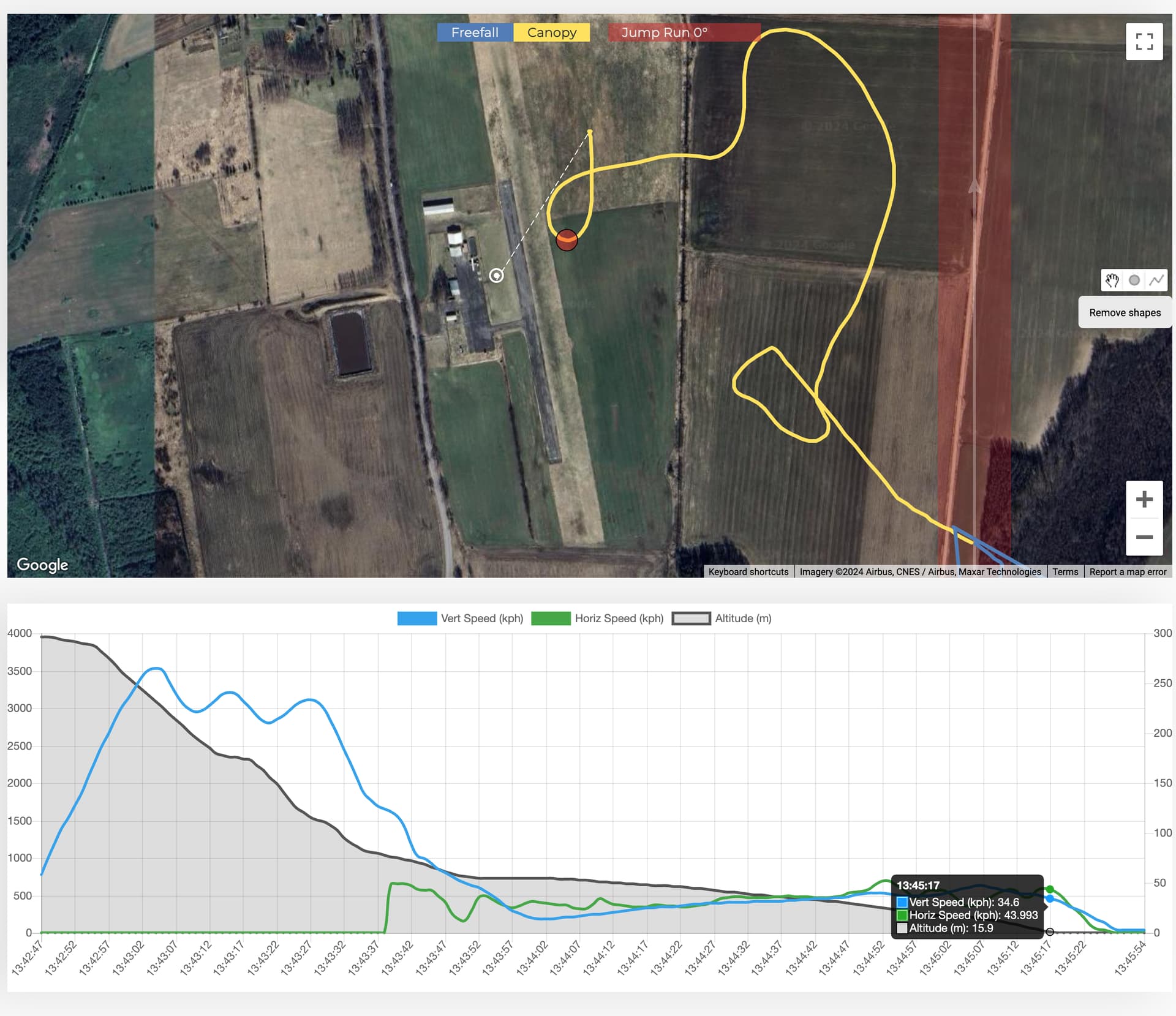
Dekunu has a great feature that allows you to view canopy flight data on a map, which can be super helpful for improving landings. However, in my case, the canopy flight data is not accurate. For instance, in this example, there is no way I’m coming out of a 270 turn at 15 meters.  I would estimate the difference to be about 100 meters. Is there a way to calibrate this?
How has everyone else’s experience been with the data on maps?
Normally, altimeter should calibrate itselft when you restart it and waited 10 minutes before jumping, before that make sure you selected your DZ as default from jump settings, and also after jumping check that its set correctly once its uploaded to cloud. Dekunu recalibrates the info on the alti when its sent to the cloud to fix some issues, but sometimes it makes it worse, or funny lol
It doesn’t help. I’m looking at the altitude on my wrist before doing a toggle surge, and the data is about 100 meters off the correct altitude. When comparing the wrist altimeter reading to the jump log in the cloud, the data doesn’t match. Does anyone else have a similar issue? Does anyone use Dekunu cloud log to analyze canopy piloting and landings?
If you are interested in analysing your canopy flight I suggest looking into FlySight. Dekunu is as good as your phone’s GPS; may not always give you the best results, because its primary function is altimeter.