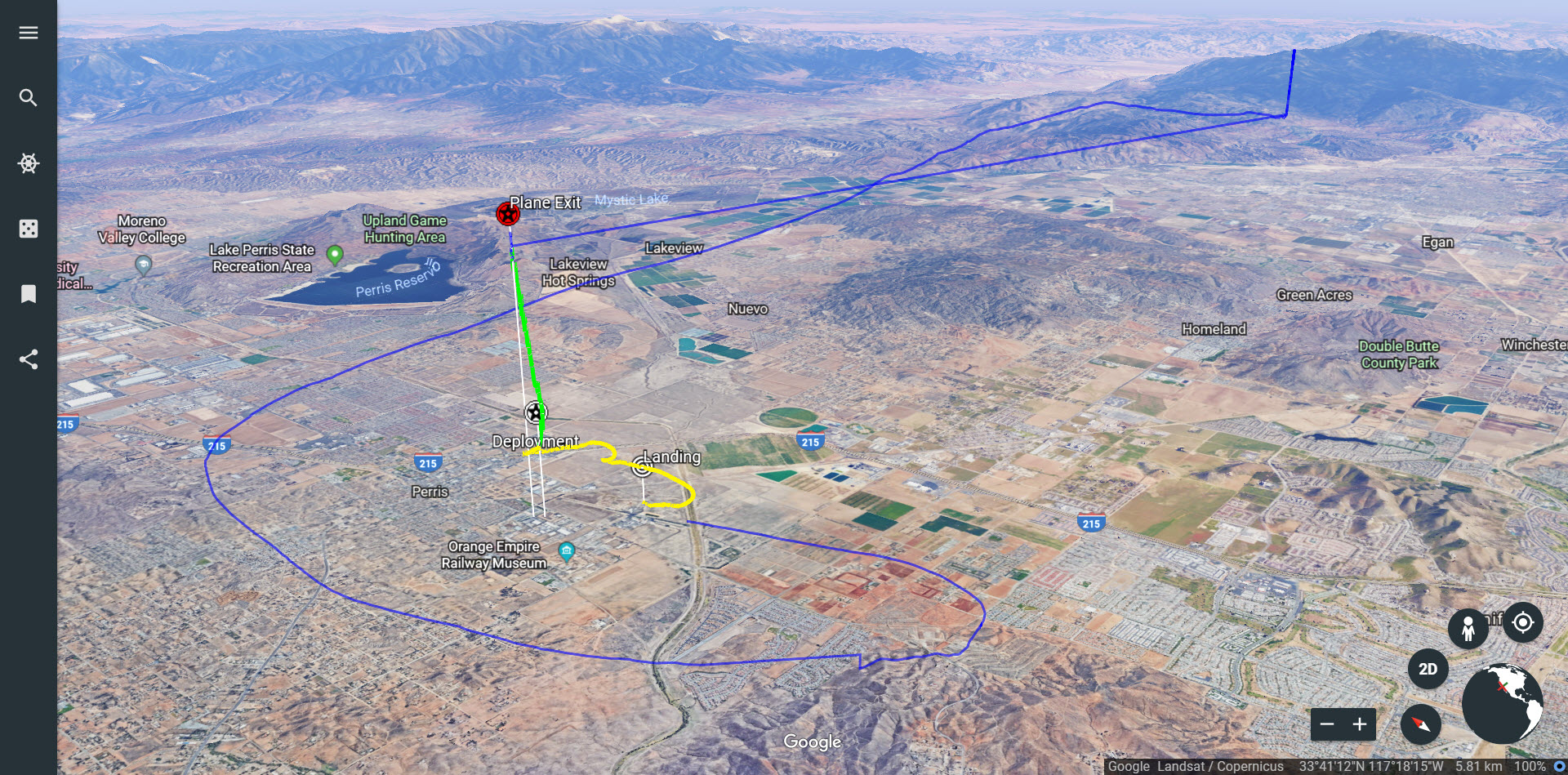
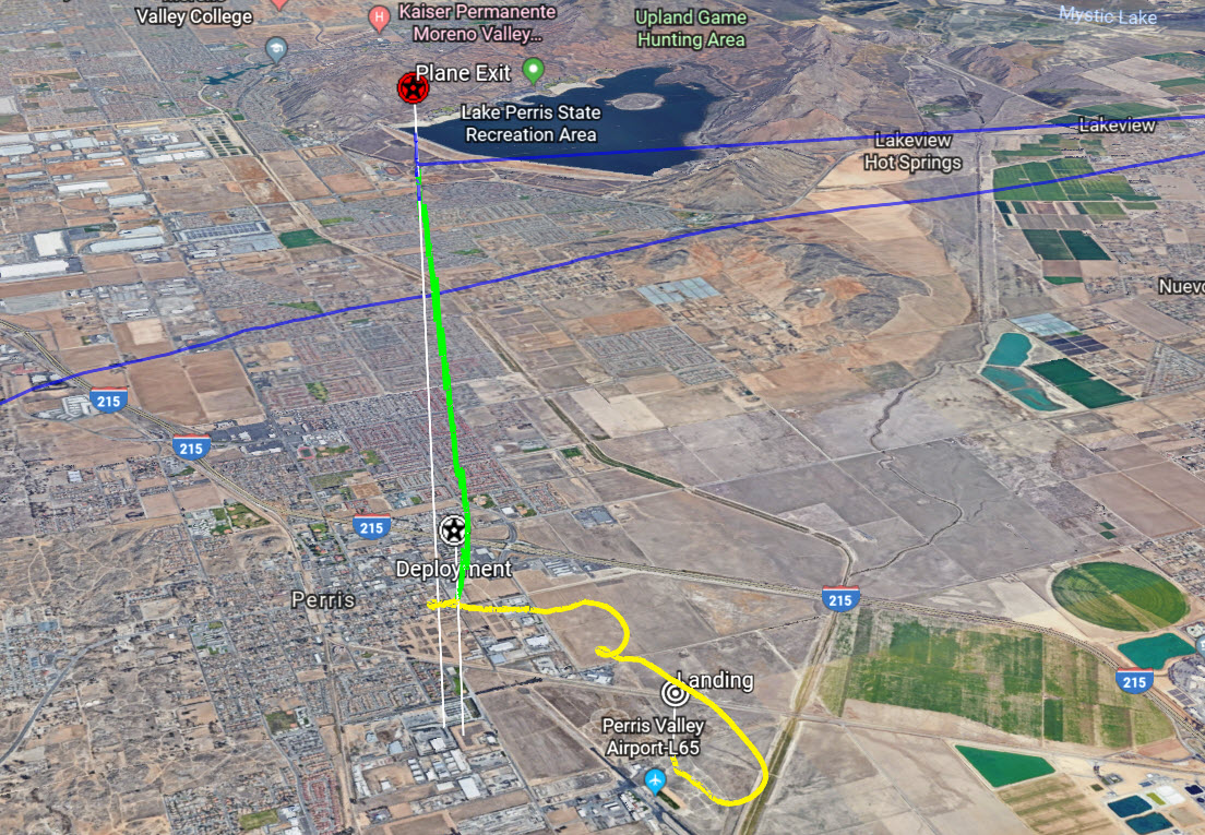
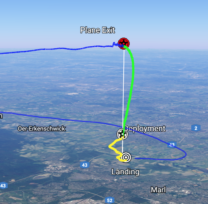
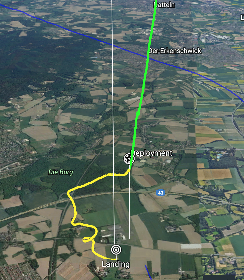
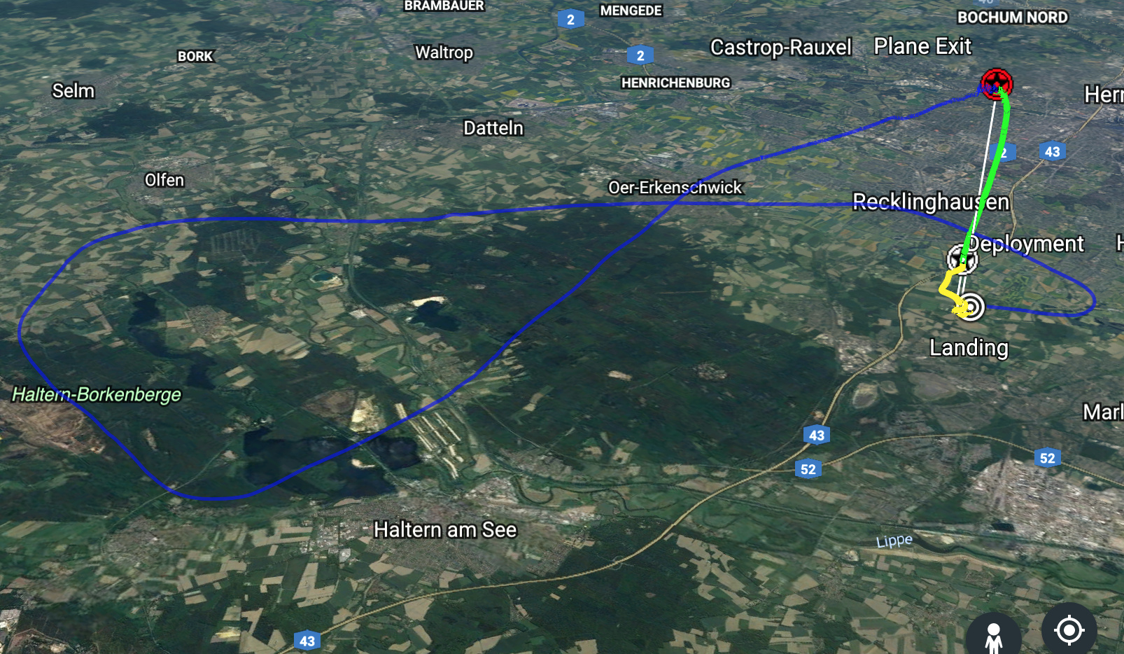
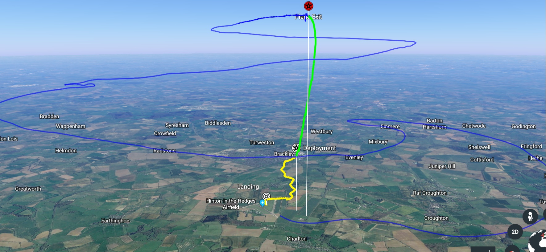
Not sure if this is the right place to post…but I just found this cool way to view your jump data in 3D for those interested. Go to your cloud portal, and on any one of your jumps export the .kml file. Then head over to https://www.google.com/earth/ and sign in with a google account. You can also use the older desktop version of google earth, but I think the newer one looks better. On the left click on the 3 lines to expand the sidebar, go to My Places then enable kml import at the bottom. Import the file you downloaded from the portal and now you can see your whole jump in 3D. Pretty cool huh? 
8 Likes
Nice, will have a look at that when I get the chance. 

Awesome!!! Thanks for this hint! Great one! Again it shows about the possibilities off this piece of equipment! Anybody tried this before with a Visio? 
3 Likes
Awesome. just tried it. looks great
1 Like
Haha, this is so cool,
Just got it working on iOS.
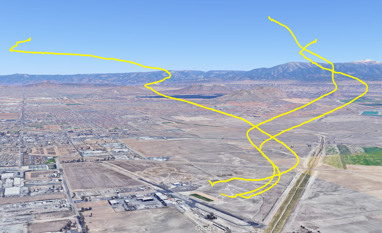
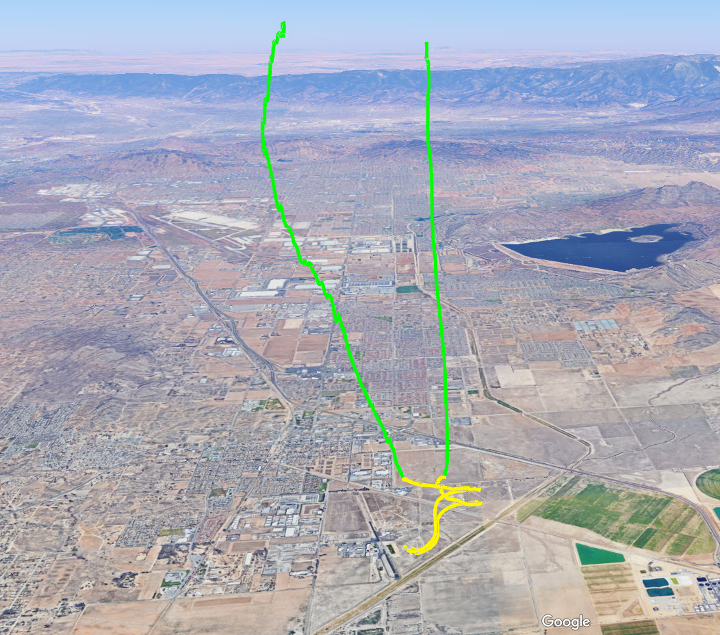
You can also add multiple kml files together to show different jumps relative to each other. Switching off certain markers or paths can be helpful if you want to zero in on just freefall or canopy. These are just from my own separate jumps, but if you jump with someone who also has a Dekunu you could import both kml files to see both jumpers flight paths from the same jump. You can also change the default color of the paths which might help better differentiate the jumpers.
4 Likes
@Nailhead this is a very cool find! I’m able to import single kml files but I haven’t figured out how to do multiples yet
@Joe, you can import them one by one. Once you have done that, you can choose if the individual jump is displayed or not (a “eye-like icon” on the left hand side in the menu bar). If you choose more than one, then all of them are displayed at the same time.
1 Like
well found @Nailhead - there are even more features that we will add to the exported KML file in the future along with refined smoothing algorithms and customisations. Also worth noting that this and other 3D tools will all be built in to the cloud so the need of external software will not be required. Super exciting! Glad you’re enjoying it
3 Likes
@mutley
How did you visualize using iOS?
Exporting the KML file is clear
But which app did you use for the visualization?
BR,
Bruce
@Bruce
Just google earth,
https://itunes.apple.com/gb/app/google-earth/id293622097?mt=8
Once downloaded, go into your cloud, click on the KML link, it will ask you if you would like to open in google earth.
You can view your other files too and over lay them by opening settings - “my places”


4 Likes
Thanks man. Really appreciate it.
2 Likes
Not to worry dude, hope you get it working, have fun.
Works like charm and is even better than on the desktop, because the touch implementation of the iOS app is far superior.
1 Like


Hi all. Has anyone got an old KML file they could share with me?
1 Like